
By Glenn Kohler, Forest Entomologist, DNR, glenn.kohler@dnr.wa.gov
An aerial survey tallied 257,000 acres of Washington forestland damaged by bark beetles in 2021, with all species but one showing a decrease from past years.
Pine bark beetles, Douglas fir beetles and fir engraver beetles all showed decreases, while the western pine beetle damaged 37,800 acres, the highest level recorded since 2006. Other damaging insects, the Douglas fir tussock moth and the western spruce budworm, showed no new defoliation and a decline, respectively.
Of the 19 million total acres surveyed, 555,000 acres were found to have some level of tree mortality, defoliation or foliar disease, down from the previous survey, completed in 2019, showing 658,000 acres of damaged trees. While the bark beetles accounted for 257,000 acres of damage, another 91,000 acres can be traced to bears and root disease, and 84,000 acres of trees were damaged during last year’s heat dome.
Every spring, the Washington Department of Natural Resources and the U.S. Forest Service publish a Forest Health Highlights report that summarizes forest health conditions and trends across Washington from the previous year. The 2021 report and previous year’s reports are available on DNR’s forest health website.
Information for the report is gathered through annual monitoring projects and special surveys in response to recent forest damage events conducted by DNR and the Forest Service. Examples include an annual aerial survey, insect trapping, baiting streams for the pathogen that causes sudden oak death, and installing ground plots to monitor emerging forest health issues, such as sooty bark disease in maple trees. The report also includes information on long-term field research efforts, such as evaluation of white pine blister rust resistance in trees established at sites throughout Washington.
In addition, the report summarizes recent wildfire activity, weather events and drought conditions that may affect forest health, and updates on forest health initiatives such as Washington’s Forest Action Plan. Maps, charts, photos, and brief descriptions make much of the information in the report accessible at a glance. For those who want more detail, it includes links to other resources like maps and data and the contact information of forest health specialists.
Annual Insect and Disease Aerial Survey
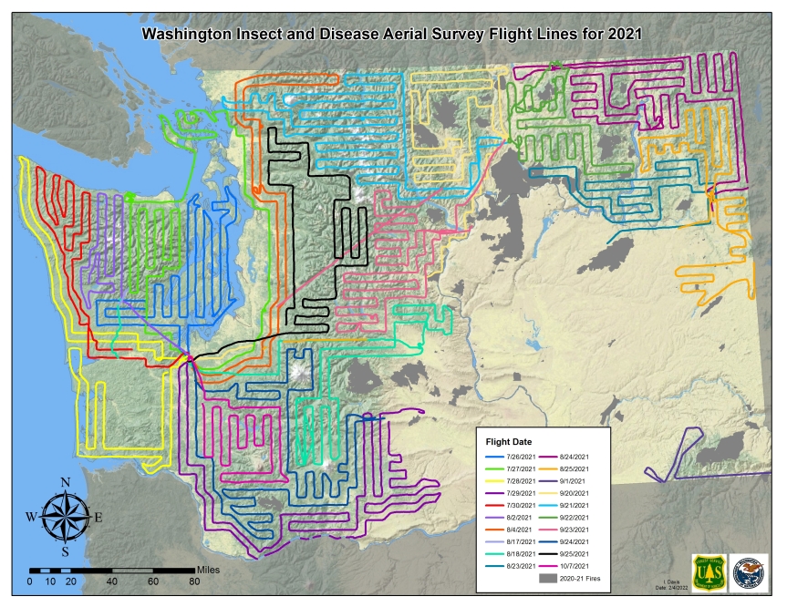
An annual insect and disease aerial survey conducted by the Forest Service in cooperation with DNR covers the majority of Washington’s 22 million acres of forested lands and provides much of the trend information in the report. Since 1947, aerial observers have reported the location and intensity of damage by forest insects, diseases, and other disturbances across all ownerships of forestland in Washington.
Without aerial surveys, it would be impossible to track disturbance conditions over such a large area using ground-based methods. Aerial survey is also an important tool used to detect and map new outbreaks of native and exotic insects and diseases. The total area mapped with some type of damage varies each year from a few hundred thousand to nearly two million acres.
In 2021, approximately 19 million forested acres across Washington were surveyed. About 3 million forested acres – 13 percent of the 22 million forested acres in the state – were not included due to fire activity, as well as limitations on aircraft and observer availability. No survey flights were conducted in 2020 in order to lower risk of COVID-19 exposure and spread among flight crews and their contacts. In place of aerial surveys in 2020, the data used for statewide insect and disease surveys were acquired through a combination of ground sampling and remote sensing.
In 2021, the aerial survey recorded some level of tree mortality, tree defoliation, or foliar diseases on approximately 555,000 acres of the 19 million acres surveyed. This is a decrease from the 658,000 acres with damage in 2019, the most recent year with a complete survey.
The area with damage from mortality agents was approximately 433,000 acres, including 257,000 acres attributed to bark beetles and 91,000 acres attributed to bear damage or root disease. Approximately 33,000 acres with damage were attributed to defoliators and approximately 89,000 acres were assigned tree damage due to other causes, including 84,000 acres with needle desiccation damage from record-breaking temperatures in late June.
It should be noted that disease damage is significantly underrepresented in aerial survey because symptoms are often undetectable from the air.
An extreme heatwave that occurred during the last weekend of June 2021 resulted in desiccation damage, primarily to new needles and buds of conifers on the south and west facing sides of tree crowns. Approximately 84,000 acres with this type of damage was recorded by aerial survey, primarily in western Washington. The extent of damage was likely underestimated by aerial survey because crown discoloration was difficult to see by observers looking to the west and south. Many different tree species were impacted, with damage most visible on conifers including Douglas fir, western hemlock, western redcedar, and Pacific silver fir. For more detail on heat-related tree damage, see the April 2022 Small Forest Landowner News article, “Aerial Survey: Coastal Areas Hit Hardest by 2021 Heat Dome.”
The area with mortality caused by pine bark beetles in 2021 was approximately 92,500 acres, the lowest level recorded since 2015. Mountain pine beetle damage decreased from 86,500 acres in 2019 to 53,100 acres in 2021. Part of this decrease may be due to reduced survey area around wildfires that include a portion of recent mountain pine beetle outbreaks in northwest Yakima County.
Mortality of Ponderosa pine in eastern Washington due to western pine beetle has increased steadily since 2012 and reached a peak of 37,800 acres in 2021, the highest level since 2006. The 2021 total is likely an underestimate due to reduced survey area in eastern Washington around several 2021 wildfires. Recent drought conditions are likely an important driver of these increases.
Mortality due to Douglas fir beetle decreased to 51,700 acres in 2021, departing from a recent pattern of growth in recent years that reached a 10-year high of 69,100 acres in 2019. Fir engraver mortality, primarily in grand fir, also decreased in 2021 to 52,500 acres, after a similar trend that also reached a 10-year high of 166,300 acres in 2019.
Outbreaks of Douglas fir tussock moth in Kittitas, Chelan, and Okanogan counties have collapsed with no new defoliation reported in 2021. No new western spruce budworm defoliation was observed from the air in northeast Washington, where the most recent outbreak is declining.
The possibly non-native sooty bark disease of maple, caused by the fungus Cryptostroma corticale, continues to be detected around the Seattle area, with additional samples found as far north as Bellingham, as far south as Olympia, and as far east as Rattlesnake Lake in King County. These samples have confirmed the presence of C. corticale on eight maple species, horse chestnut, Pacific dogwood, and cherry plum. The full distribution of this pathogen is not known, so a survey covering western Washington is planned for summer 2022.
Phytophthora ramorum, the causal agent of sudden oak death, continues to be found in streams associated with commercial plant nursery trade activity, but there has yet to be any indication that the pathogen is leaving the waterways and impacting bordering vegetation.
Maps and Other Aerial Surveys
Whether you are a regular user of aerial survey maps and data or just learning about what’s out there, check out some of the ADS products now available.
- Downloadable PDF aerial survey quad maps from 2003 to 2021 are available from the US Forest Service, Pacific Northwest Region
- Interactive, web-based aerial survey maps are available to explore: To view, select Forest Health > Annual Aerial Survey Data.
- The USFS maintains current year aerial survey data in an interactive, web-based map. Click on the “Data Viewer” link to create customized electronic maps with a variety of background layers.
- Washington’s annual Forest Health Highlights report is available online and includes information on how to access downloadable GIS layers.
If you have any questions about these products or need information about forest insects and diseases, please contact the DNR Forest Resilience Division at 360-902-1300 or email: forest_health@dnr.wa.gov.
